
When the COVID pandemic hit at the start of 2020 and the world went into lockdown, the rail industry faced unprecedented challenges overnight, not least the need to sustain track and infrastructure surveys that inform cost and safety critical decisions in rail asset management.
Among its many commitments to rail clients worldwide, the geo-data specialist Fugro was already scheduled to undertake measurement surveys for High Output Track Renewals using its RILA system on preselected train routes lines to ongoing program deadlines.
Rail Express speaks to Fugro Business Development Manager (APAC) Bill Jones about the introduction of the RILA technology into the APAC region, bringing world class solutions into the evolving need for the digitalisation of rail networks.
“The system brings safety improvement and operational cost reductions, along with more remote operations to deal with the challenging and changing work environments we are all operating in today,” he said.
“The latest onboard survey systems like RILA can record and measure all necessary track and rail corridor data mounted on normal service trains, avoiding the need for special survey engines and line possession.
“Combining video, surface, and subsurface scanning, supplemented by LiDAR aerial imaging, the technology is mainly remotely deployed, removing the need for personnel to work on the tracks and reducing the associated safety risks.
“These self-supporting systems allowed surveying to continue largely unaffected by the pandemic and with a reduced burden of social distancing and protective measures for the small number of personnel involved.”
Fugro’s RailData services, using innovative 3D surveying and testing technologies, can accurately create 3D models for the evaluation of entire rail networks quickly, safely, and comprehensively – this includes all gantries, signaling, tracks, buildings, and vegetation within the railway corridor.
Clever software crunches essential information, from sub-millimeter rail wear measurements to track-bed construction and underlying geology.
By bringing all this railway insight onto the desktop, asset managers and rail engineers can analyse and extract actionable information both quickly and efficiently.
This type of slick data collection and 3D asset modelling has facilitated three other advances designed to make life easier for rail asset managers, whether working under pandemic constraints or not.

A revolutionary approach to tamping
Adopting a ‘design first’ approach to tamping, Fugro’s Smart Tamp solution aims to radically improve outcomes from tamping, the essential intervention that maintains track alignment to prevent derailments, reduce wear and tear on rolling stock, and achieve a smooth ride.
Smart Tamp maintains an up-to-date model of the current geodetic track position for all track sections being monitored, including the relationship of track position to surrounding assets.
First and foremost, this provides insights for maintaining track geometry so that dynamic forces are reduced, with the goal of keeping maintenance costs down for track and train operators. Where sections are identified for maintenance, the geodetic model can provide the basis for the new track design, removing the need to send surveyors to track while also allowing the track alignment to be optimised.
The approved track adjustments generated via virtual engineering can then be loaded into the tamper control system to improve the quality and efficiency of the track maintenance process.
“The product of a UK government innovations initiative, Smart Tamp has been tested and shown to improve track alignment, removing longer wavelength defects which are often created over time by conventional maintenance tamping,” Jones said.
“At its heart, it facilitates better design tamping by enabling the alignment to be optimized through the whole corridor, rather than just the section in need of tamping. Positional information can be passed to the tamper at increments ≥ of 1 metre, allowing the track to be positioned exactly where the design requires with no interpolation needed by the tamper.
“This ensures that the best alignment is applied to create smoother transitions and curves for reduced wear and a more comfortable ride for passengers.”
Harnessing the power of the digital twin
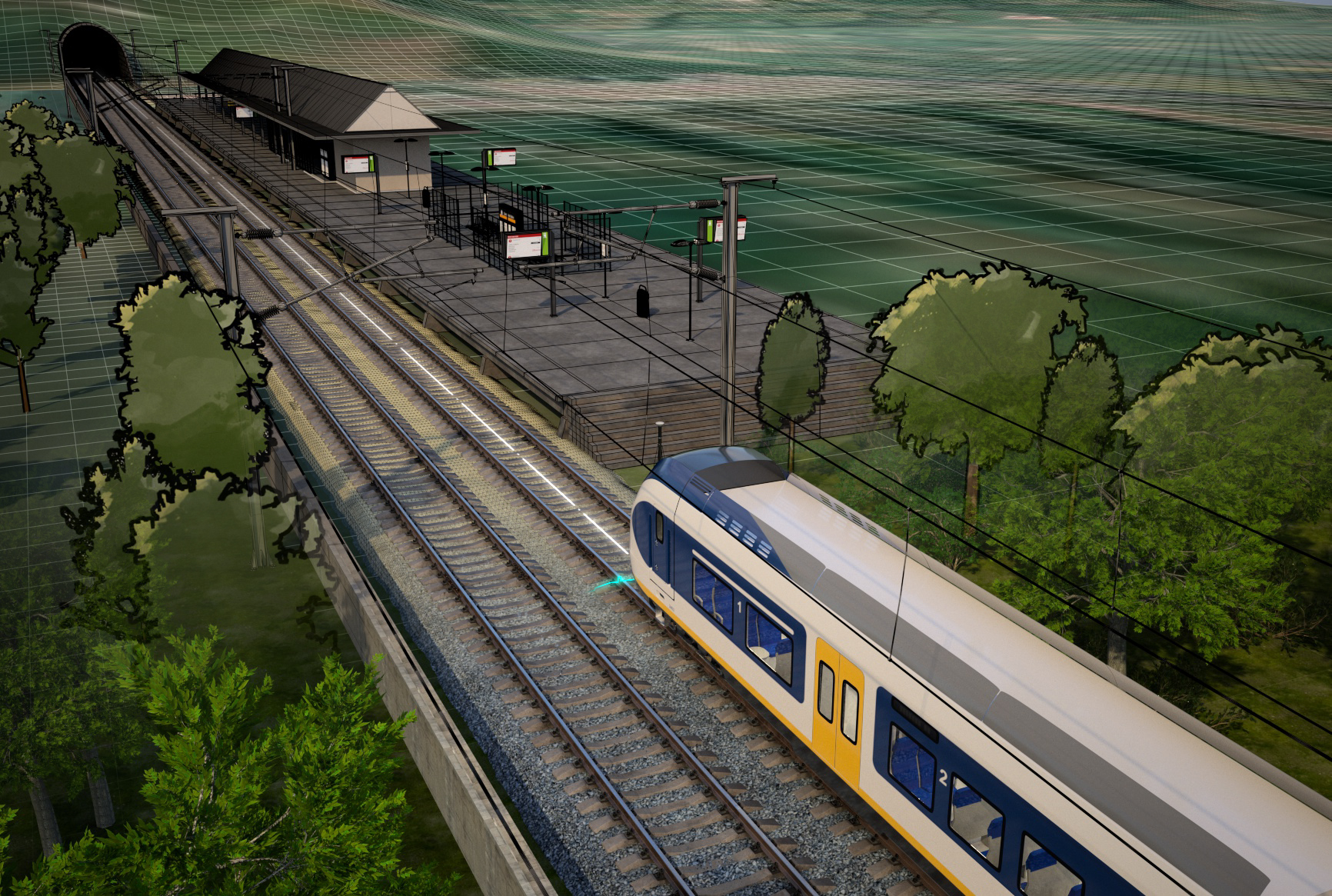
Fugro’s RILA monitoring system provides a digital twin of the entire rail corridor giving rail managers accurate, up to date information to support robust decision making and help optimise railway operations and cost.
The frequently updated high-quality data allows engineers to monitor essential infrastructure assets, detect changes, and avoid unplanned incidents by being in control of track data The RILA measurement system incorporates a 360° lidar scanner and a panoramic camera system to simultaneously acquire lidar data and imagery of the track and surrounding environment.
The system is mounted on a locomotive and can survey vast areas of rail network, even a whole network within a month. With a highly accurate, immersive view of the track corridor – a so-called ‘digital twin’ – the video footage is positionally merged with processed point cloud data from Lidar.
The Lidar data is analysed and categorised into feature classes such as rails, sleepers, vegetation, ground, and so on. Clearance information is also extracted and imported into the client’s software.
Expanding the asset manager’s tools for remote viewing and decision-making, Track Twin assimilates and models data on the track centerline, overhead catenary, ballast profiles, signaling systems, cable runs, structures, and other parameters such as track distance, height, and stagger. This additional dimension of visual asset data helps with the following:
Vegetation management along the tracks and catenary systems to ensure trains can pass safely and maintain the accepted safety distance to specific parts of the catenary systems
Track maintenance to assess the need for ballast supplements before maintenance; for example, tamping operations, and to identify the locations of break- and edge-points and the slope of the embankment in the ballast profile of the track from ditch to ditch
Identification of the overhead contact systems, extracting information from the lidar data on the location of the catenary masts, contact and catenary wires, return conductor and line feeder. Even the height of the contact wire over the track centerline is reported.
The RILA ‘digital twin’ improves network safety in targeted and systemic ways. The visual model can help a client to detect objects within the rail corridor that conflict with the passing clearance of a train, offering the facility to perform clearance gauge mapping as the basis to planning remedial work.
“Representing an up-to-date and accurate digital twin of the entire railway, it provides a robust, data-rich virtual picture as the basis for optimising railway operations, proactive decision-making, and improved engineering work,” Jones said. “By reducing the need for boots on the ballast, a digital twin enhances safety and removes risk with fewer field visits needed to plan, scope, and inspect.”

Virtual management of trackside vegetation
With the unpredictable impacts of climate change on the lineside environment, Fugro’s latest rail solution is Vegetation Control, a powerful tool to measure, monitor and manage trackside vegetation asset from the desktop.
Lineside vegetation management uses risk assessment to support the safe running of railway networks with inspection works, management and maintenance operations being used to mitigate and control risks.
The Vegetation Control application captures and automatically classifies lidar and image data to flag areas where vegetation is encroaching on the track or overhead line equipment (OLE), or where there is an imminent risk of danger.
With the addition of aerial imagery, monitoring risks include the identification of individual trees of falling distance, that is, trees posing a risk to the safe operation of trains if they were to fall, and zones of vegetation encroachments.
Risk locations also include areas with signs of damage to railway infrastructure and/or third-party assets, and areas of invasive vegetation and/or weeds. This provides asset managers with a tool that can help them monitor, plan, and implement appropriate vegetation management at the right time, while increasing efficiency, mitigating risk, and reducing operational costs.
Using a highly automated algorithm to process data, Fugro’s Vegetation Control helps to identify risk locations such as sites where vegetation impacts on overhead line equipment, signal sightings, railway access, and positions of safety.
Improving safety and cost control with Vegetation Control Historically, the mapping of vegetation in rail management has been fraught with difficulty and limitations, from the constantly changing state of an organic feature to the risks of deploying survey personnel trackside.
“With the use of live, precision imaging that constantly tracks and locates changes, it is now possible to create an objective inventory of vegetation and measurement of maintenance efforts without the need for workers on the tracks,” Jones said.
“Data collection is frequent and cost-effective, enabling predictive maintenance, strategic vegetation management, and consequent cost reduction. Rail managers can actively and accurately reduce or eliminate vegetation risk in compliance with local regulations while proactive maintenance prevents incidents, penalties, and possible damage to reputation.”
Complemented by a range of track-bed investigations, geotechnical engineering and track engineering services, the Fugro RailData track environment geo-model supports all stages of the network life cycle.
Multiple, cyclical surveys can be performed to gather data on key rail maintenance parameters without affecting train service and or needing any personnel or dedicated measurement machines on the track.
By making the most of remote survey methods and virtual asset models, Fugro’s rail solutions offer clients an advanced level of asset insight collected with minimal impact on network services and reducing workplace risk.
“COVID has now shown that this approach also provides significant operational resilience and business adaptability in the face of unprecedented events,” Jones said.
About Fugro
Fugro is the world’s leading geo-data specialist, collecting and analysing comprehensive information about the Earth and the structures built upon it.
Adopting an integrated approach that incorporates acquisition and analysis of Geo-data and related advice, Fugro provides solutions. With expertise in site characterisation and asset integrity, clients are supported in safe, sustainable and efficient design, construction and operation of their assets throughout the full life cycle.
Employing about 9000 people in 61 countries, Fugro serves clients around the globe, predominantly in the energy and infrastructure industries, both offshore and onshore. In 2020, revenue amounted to EUR 1.4 billion. Fugro is listed on Euronext Amsterdam.
Website: www.fugro.com